
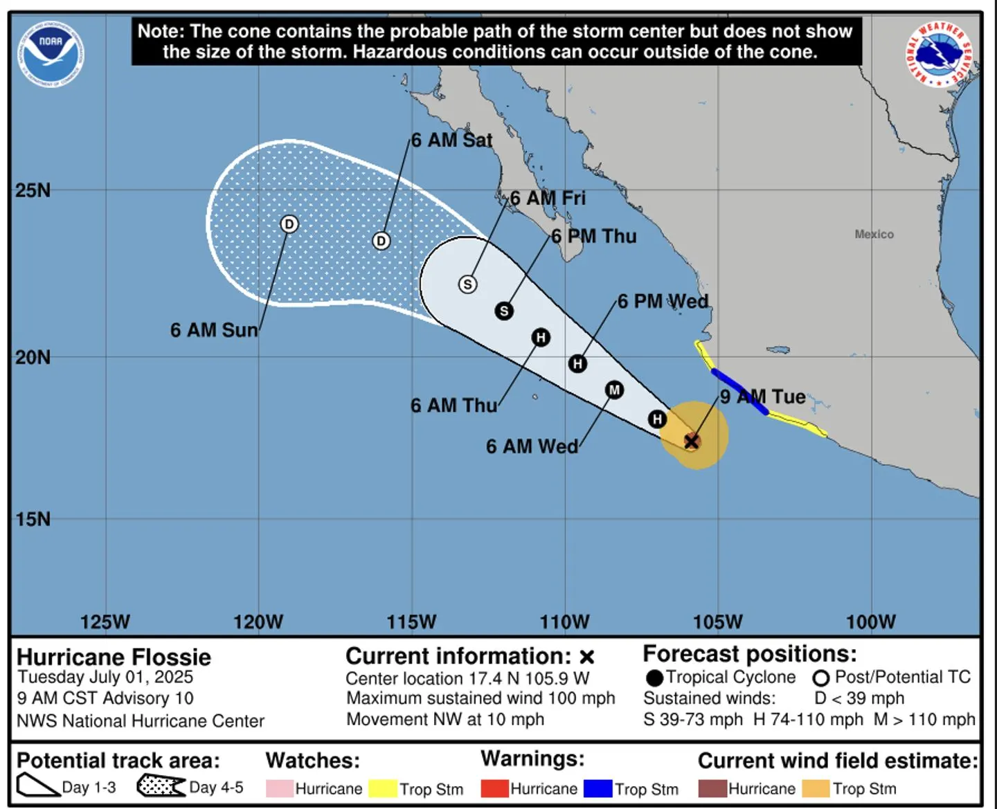
All eyes in southern Baja are on the newly formed Hurricane Flossie, a powerful Category 1 storm churning in the Pacific Ocean. While the name may conjure images of a direct hit, the latest official forecast brings a message of cautious relief for Los Cabos.
According to the National Hurricane Center (NHC), the trusted and sole source for storm information, Flossie’s current path is expected to keep the destructive hurricane-force winds well offshore. However, the storm is still projected to pass close enough to generate significant and dangerous impacts for the southern tip of the peninsula.

Here at The Cabo Sun, we’re breaking down the official forecast and explaining what this means for travelers and residents: no need to panic, but every reason to be prepared and respect the ocean.
The Official Forecast: A Close Pass, Not a Direct Hit
The NHC reported early Tuesday morning that Hurricane Flossie is located about 155 miles south-southwest of Manzanillo, Mexico, with maximum sustained winds near 85 mph. While forecasters expect it to strengthen over the next day, it is forecast to move farther away from the Mexican mainland and pass south of the Los Cabos region by late Thursday and Friday.
Crucially, as of the latest advisory, no hurricane or tropical storm watches or warnings are in effect for Baja California Sur. The forecast cone, which shows the probable track of the storm’s center, keeps the most dangerous core winds well out at sea.

The Real Impact for Cabo: It’s All About the Surf
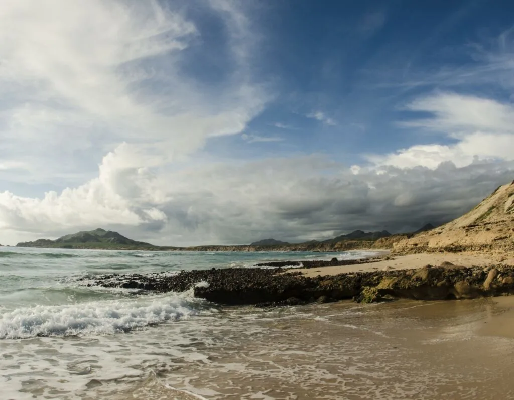
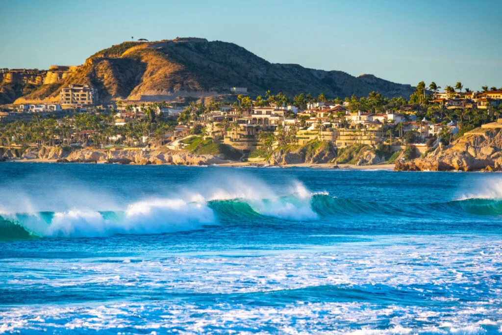
While Los Cabos will be spared a direct hit, it will not escape the storm’s influence. The biggest and most dangerous impact will be the surf. Even a distant hurricane generates powerful, long-period ocean swells, often called “mar de fondo,” that travel hundreds of miles.


The NHC expects these swells to create life-threatening surf and rip current conditions along the coast of southern Baja California Sur starting Wednesday and continuing through the end of the week. This means that all Pacific-facing beaches, from the Tourist Corridor to the areas around the Arch, will be extremely dangerous. It is critical that all visitors and residents stay out of the water. Swimming, surfing, and even wading will be hazardous. The Port Captain is expected to close the Cabo San Lucas port to all small craft and tour operations during this period.

What About Wind and Rain?
As Flossie makes its closest approach, its outer bands will still lash the Los Cabos area. Residents and visitors should expect periods of heavy tropical rain and gusty winds starting late Wednesday and peaking on Thursday.
While these winds are not expected to be destructive, they will be strong enough to make for an unpleasant day outdoors. The primary concern with the rainfall, which could total 2 to 4 inches in some areas, is localized flooding. Cabo’s famous arroyos (dry riverbeds) can fill with rushing water in minutes, making some unpaved roads impassable.


For travelers, this means a couple of days of indoor plans and canceled ocean excursions. For the region, it means a much-needed dose of rain after a long dry season. The key is to stay informed, stay safe, and above all, stay out of the dangerous ocean.
The Ultimate Cabo Trip Planner
When’s the best time to go? Our powerful month-by-month guide breaks down the weather, crowds, hotel rates, and whale watching seasons for your perfect trip.
Find Your Perfect Los Cabos Resort In Seconds
This simple, powerful tool was built by our on-the-ground experts to match you with the ideal resort for your specific budget and travel style.
Subscribe to our Latest Posts
Enter your email address to subscribe to The Cabo Sun’s latest breaking news affecting travelers, straight to your inbox.